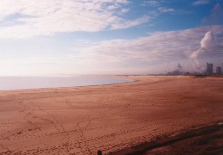
by Martin Blick
August 2019
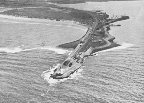
This man-made promontory sticks out into the Tees Bay by around 2 miles and was created in the 1880’s from waste slag (a by-product of the booming iron and steel industry). It was built to protect the river mouth and the ships that entered it, in conjunction with the North Gare, a mile away across the river.
Over the decades, nature has taken its course and parts of the South Gare look quite scenic with rolling sand dunes and a few assorted trees and bushes and reed beds.
Unfortunately, there is no access restriction to the area, despite parts of it being a Special Protection Area; consequently, some of the roadside verges resemble rubbish tips, the parking areas at the seaward end are generally strewn with litter, many people use the area as a dog-walking park and, at times, vans/mobile homes are parked there (and lived in) for weeks at a time.
Despite all of this, it is still a good birdwatching area, attracting numbers of waders, terns and gulls at various times through the year, and it is always worth checking high tide times, as much of the seaward side is tidal.
During migration times, principally mid-April to mid-June and early August to late November, very large numbers of migrants can be found, especially if the birds are experiencing bad weather. It generally only happens 2-3 times a year, but thousands of birds can be recorded; Wheatears, pipits, hirundines and warblers in spring, and thrushes, Woodcock, Blackcaps, Goldcrest and owls in autumn.
Access is from the Western end of Redcar: York Road runs West from the only roundabout at that end of Redcar (NZ592250), then becomes Tod Point Road as it passes through Warrenby, which is essentially an industrial estate and does a sharp right by the last building.
The road goes over an old level crossing, known as fisherman’s crossing (NZ579252) and this is the point at which South Gare begins as a recording area. The road immediately turns left, then right and right again as it follows the old steel works fence and there are many bushes to the right as one progresses North. These regularly hold migrants. Another sharp left in the road brings one to the reed and marsh areas, although, in recent years, they have tended to dry out in the summer. The first bushes encountered on the left are known as the shrike bushes, and opposite is the area known as the quarry, although it is more accurately a slag tip with a raised plateau.
From this point the road is virtually straight but narrow in parts, and more bushes and small trees can be seen on both sides of the road. A flat low-lying area to the right is known as the lagoon because it used to be tidal, but sand dunes have shifted across its entrance and it has not had water in it for more than 10 years. The cabin rocks are visible next on the right, with about 50 uniform green cabins just behind the sand dunes and finally, the actual promontory that juts into the sea. The last 200 metres of the gare have recently been fenced off, although access to the last few bushes is still possible.
Sea-watching can be quite good at South Gare, although the recent (2012) installation of 27 wind turbines to the East of the gare has had a detrimental effect.
Good numbers of Guillemots, Eider, Shags, Terns and gulls can still be recorded from time to time, and unusual seabirds like Little Auk, Sabine’s Gull, Grey Phalarope and all 4 skuas have been seen at times. The list of unusual passerine migrants is spectacular and includes several Rose-coloured Starlings and Bee-eaters, as well as commoner rarities like Firecrest, Bluethroat, Red-breasted Flycatcher, Shorelark, Richard’s and Tawny Pipits, Icterine, Marsh, Radde’s, Dusky and Pallas’s Warblers and 3 species of shrike.
The rarest birds seen here are the Cliff Swallow in October 1988 that was the 2nd UK record, and the Lesser Crested Tern which was seen along the English East coast every summer from 1984 to 1997.